Eyesis4Pi 393

From ElphelWiki
Revision as of 10:27, 22 December 2016 by Oleg (talk | contribs)
Jump to: navigation, search

Status

Available

Overview

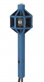
Eyesis4pi 1a.jpeg
Elphel Eyesis4Pi-26-393 is the newer generation of the full-sphere multi-camera systems for stereophotogrammetric applications.
  • The system is calibrated to compensate for optical aberrations allowing to preserve full sensor resolution over the field of view.
  • Distortion calibration is performed for precise pixel-mapping to automatically stitch images into panoramas, and also for photogrammetry and 3D reconstruction.  
  • There are 24 x 5MPix sensors in the camera head, resulting in 120 MPix image acquisition. Panorama image resolution after stitching is 64 MPix, the equirectangular projection is 14000x7000.
  • High-precision Inertial Measurement Unit IMU (ADIS 16375, 2400 samples per second) is integrated with the camera, as well as 5Hz GPS (Locosys LS20031) to provide precise position and orientation of the camera.
  • Images, synchronized with IMU and GPS data, can be recorded to internal Solid State Drives (SSD), external swappable SSDs or to a PC over the network.
  • Optionally Eyesis4Pi-393 camera system includes PC for image downloading and post-processing with pre-installed SDK and Free and Open Source Software for camera calibration, image acquisition and panorama stitching.
  • Eyesis4Pi-393 can be mounted on a car for outdoor panoramic applications or carried by a person, which lets successfully create panoramas of small and narrow spaces.*

Automated panoramic imagery and 3-dimensional panoramas are the 2 main applications of Eyesise4Pi-393 camera.

* Car and backpack mounts are not included.

Improvements over older generation Eyesis4Pi

  • new 10393 system boards
    • faster recording
    • more powerful
  • more compact - the pole is 2 times shorter
  • lighter

Features

  • 4*π (360x180) full sphere coverage
  • 64 MPix panoramic image resolution after stitching
  • Final panoramic image equirectangular projection dimensions - 14000x7000
  • 0.05 Pix stitching precision
  • Calibrated fixed lens to compensate for the lenses distortions
    • 10" (0.1 pix) in the center 80% x 80% area
    • 30" (0.3 pix) maximal error over the full FoV
    • <0.03um/° thermal expansion
  • 5 FPS - maximum frame rate
  • High-precision IMU ADIS 16375
  • Images are geo-tagged - 5Hz GPS receiver (Locosys LS20031)
  • Recording to:
    • internal SSDs
    • external SSDs
    • a PC over network
  • Web Based GUI
  • SYNC cable allows:
    • receive and log external trigger (from a sensor such as odometer or extra GNSS system)
    • generate output signal to trigger other sensors or cameras
  • Free Software and Open Hardware

Calibration

We have developed full calibration process and post-processing software to compensate for:

  • Optical aberrations, allowing to preserve full sensor resolution over the camera FoV.
  • Distortions – for precise pixel-mapping for photogrammetry and 3D reconstruction.

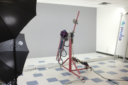
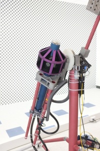
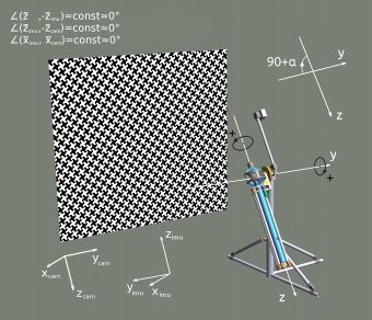
The calibration is performed using the machine (goniometer) that rotates the camera about 2 axes by precisely known angles. To calibrate IMU one needs to match the goniometer angles with the IMU data.

Check out these articles for more details:

Calibration process
Eyesis4pi393 calibration closer resized.jpeg
Calibration process drawing

3D Model

http://community.elphel.com/pictures/eyesis4pi/EYESIS4PI-26-393_resized_2.jpeg
Eyesis4PI-26-393 3D

Operating

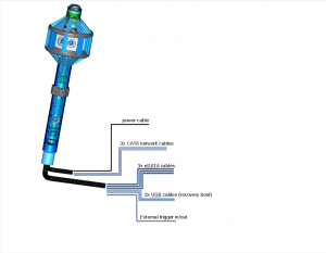
Fig.1 Cables
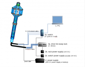
Fig.2 Recording to swappable external drives
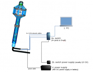
Fig.3 Recording to internal SSDs or over network
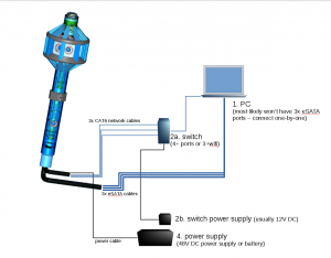
Fig.4 Downloading data from internal SSDs to PC